Commerce on the Buffalo River
Contact
University of Arkansas Division of Agriculture
Cooperative Extension Service
2301 S. University Ave.
Little Rock, AR 72204

Commerce on the Buffalo River
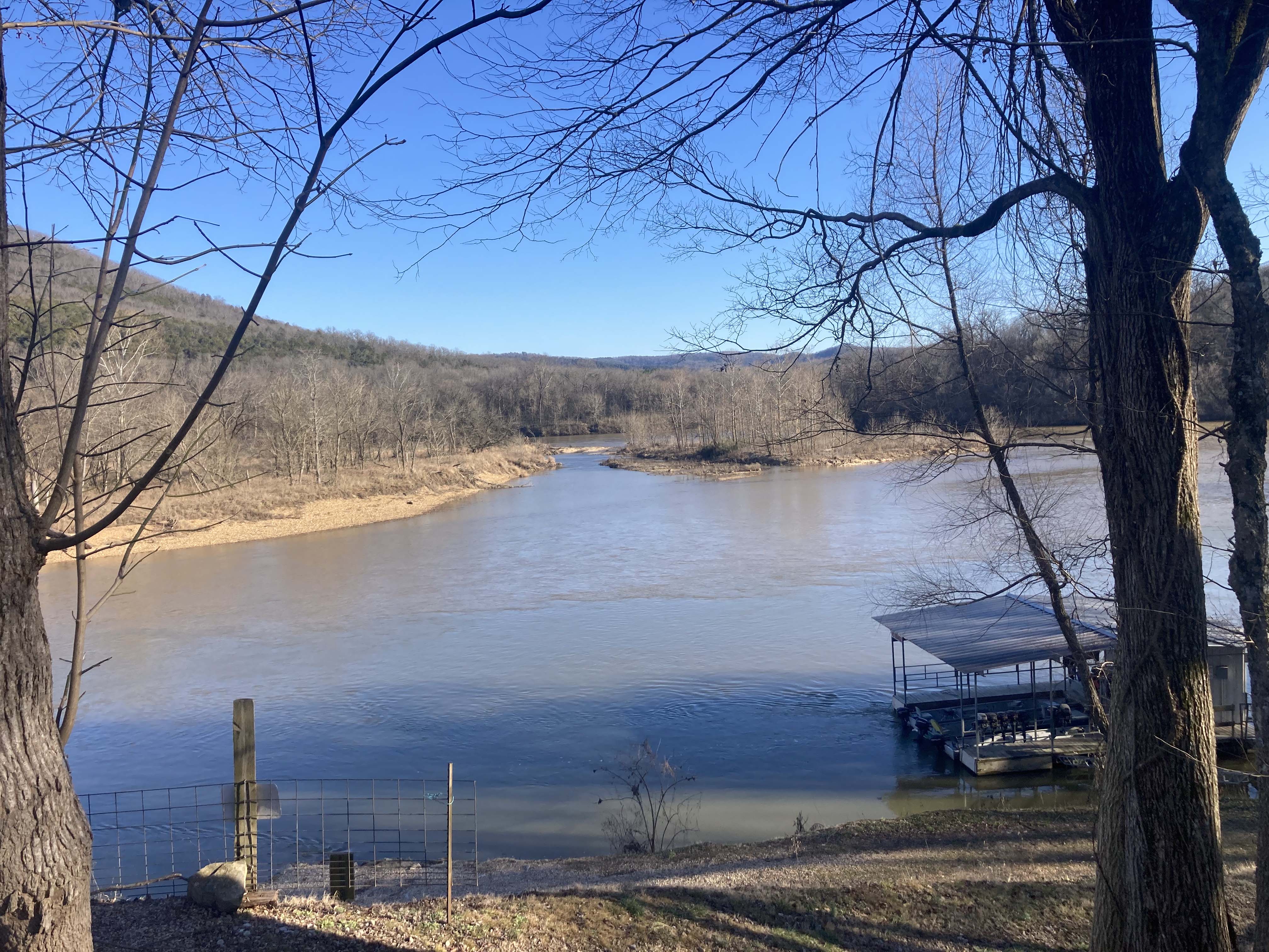
I have now driven the length of the Buffalo National River, approaching it at about 15 different locations along its course. Heading east, the valley becomes wider, with the surrounding hills not quite as high as the Salem Plateau of the Ozark dome holds sway. This is an ancient landscape, with most of the rocks more than 400 million years old. Once the highest part of the Ozarks, the high uplift has now been cut down by time and erosion, removing all vestiges of the younger Mississippian- and Pennsylvanian-age rocks that originally capped this part of the dome.
At Buffalo City, the Buffalo River dumps into the White River about 20 miles south of Mountain Home. This fishing resort has a population of 26 souls, according to the 2020 census, so calling it a city is a bit of a stretch. It turns out this new Buffalo City, situated on the east (north) bank of the White River is across the river from the original Buffalo City, which dates back to the 1840s. In a long and detailed letter written to his parents in Connecticut in the fall of 1848, Everand B. Dickinson reported on life in this tiny outpost with only four families.
Dickinson, recovering from some unnamed financial calamity, was optimistic that this frontier outpost was going to provide him with opportunities he could not get in more settled regions. He had established himself as a tradesman, buying and selling pelts, bear oil and grains that were floated down the White River. Very little cash was in circulation, so most transactions were by barter. At the time, Buffalo City was as far up the river as steamboats could go, so he felt it to be a fine location. The few farmers and early settlers were building cabins on “government land,” clearing small patches for subsistence farming. They held the land by “preemption rights,” not paying taxes on it until it was surveyed, giving the homesteader claim to the land when it was offered for legal settlement.
In the letter, Dickinson says that the river received its name because the gravel shoals at its mouth was where the “buffalo crossed the river before they followed the Indians further west.” As the land became more settled, wheat, oats and finally cotton were grown in the rich bottomland patches.
Starting in the late 1880s and continuing for little more than a decade, the Buffalo River was logged of its old-growth cedars (Juniperus virginiana). While cedar logs were sometimes used for fencing and occasionally to build log cabins, most of the old-growth trees remained untouched until the end of the 19th century. Cedar logs from more accessible regions of the South had been cut to make pencils. Pencils require soft, knot-free, straight-grained wood and Buffalo River cedars fit the bill nicely.
Logs as long as 80 feet with 24-inch bases were cut, accumulated on the banks of the Buffalo River and then rafted downriver to the White River in the spring and fall after a heavy rain. Some of these log rafts were said to contain as many as 175,000 logs. The logs were then cut into billets and shipped to factories around the country that produced pencils that sold for less than a penny each. Today the junipers have grown back but it will take another couple centuries before we see such giant trees along the dry bluffs of the Buffalo.
The original Buffalo City on the west side of the White River never became the metropolis boosters dreamed of. The Springfield to Batesville railroad line pushed through the region in 1900, originally headed to the little town. But a 700-foot-tall bluff stood in the way, so the engineers rejiggered their calculations and moved the tracks to the other side of the river. Being bypassed by a railroad or a superhighway often spells disaster for small towns, and Buffalo City started dying in 1903. Floods in 1914 and then 1927 finished it off.
Logging, mostly of shortleaf pine and oaks for railroad ties, provided the income stream for most inhabitants of the Buffalo River Valley from the 1890s until about 1920 when most of the accessible timber was gone. With the timber gone, the government began buying land in the 1920s to create the Ozark National Forest. Small-scale forestry, open-range cattle grazing and subsistence farms were the norm for the area until tourism took root in the valley after the creation of the Buffalo National River in 1972.