Road Trippin
Contact
University of Arkansas Division of Agriculture
Cooperative Extension Service
2301 S. University Ave.
Little Rock, AR 72204

Road Trippin
This evening I write this looking out the window at the sandstone spires that make up Monument Valley where all the Westerns were filmed when they still made them. To get here I’ve driven all manner of roads. Some good, some not so hot. But all were fun and interesting.
I left Minneapolis a dozen days ago on U.S. 212, a road started the same year Route 66 was launched. But maybe 66 went through more interesting places or maybe because it had a TV show and songs were sung of it, it got all the notoriety. 212 is a fine road, leaving the big city as a four-lane divided highway but as soon as the city lights are behind us, it turns into a two-laned, wide-shouldered roadway that now is routed around most of the small towns that cross its path.
The first half of the road goes through the farmland and fields of Minnesota and South Dakota. As the more moist and more fertile farmland is left behind, the soybeans and corn diminish in size. Without an underground ocean of water, this is dry land farming. Eventually, the second half of the trip gives way to grasslands, again with the pastures more lush and luxuriant at first and finally giving way to the silvery sage with grass peeking out where it can.
The third half of the road finally reaches the mountains and dramatic vistas are presented at every turn. In Montana, 212 is subsumed by I-90 for a time, but at Billings, the greedy interstate spits it out and again I am happy to be driving a real road. Not that Interstate Highways aren’t real roads. They are. But as soulless ribbons of concrete and steel designed to move things from point A to B, they have the feel of a NASCAR racetrack.
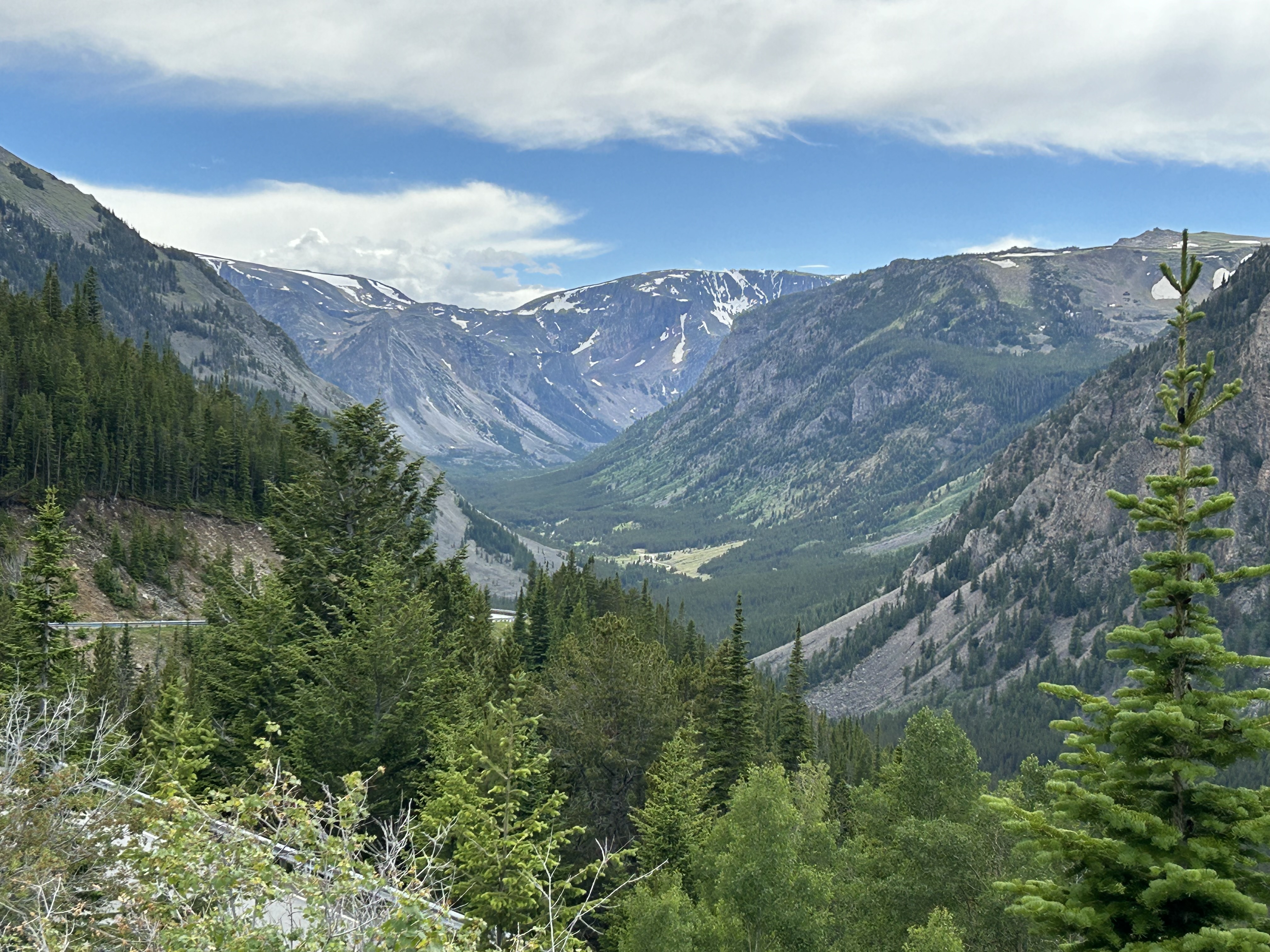
From the small tourist town of Red Lodge, nestled at the foot of the Beartooth Mountains, 212 makes its final push to the summit at almost 11,000 feet. The drive to the summit can only be described as stunning, but add to that the scenery presented from the summit to the northeastern gate of Yellowstone National Park, and you have what I judge to be the most beautiful road I have driven in America. This road was completed after WWII, so it took some time to push the road to its final destination. In the Park, 212 vanishes into the mist and the park names take its place.
Most modern travelers rely on their telephone map programs to plan routes. Google and Apple assume that everyone is in a rush, so all their routing involves interstate highways and the biggest roads. Trying to plan a trip on the smaller roads requires a bit of trickery unless one is lucky enough to have a state paper map at hand. Even atlases leave something to be desired because they often omit some of the more obscure roadways due to their smaller format. For a time I thought state maps were a thing of the past, but because governors can’t resist the chance of a little free publicity, or because somebody finally realized many travel for the joy of the experience, not to get it over with as quickly as possible.
From Idaho Falls, where my daughter lives, I wanted to track south to northern Arizona to visit my brother. The maps program routed me on interstates, swinging wide to the west of my target. I knew I could travel more or less straight south, but there is no interstate roadway to be had. So I picked out a town in the general direction I was headed and asked the map program to offer me some choices. Sometimes I opted for the quickest, most direct smaller road, but sometimes I opted for choices that looked more interesting.
Happy finds sometimes result. Piecing together my trip south, I headed south from Dinosaur, CO on the beautiful Colorado 139 to I-70 where I took a quick look at the canyon land that makes up Colorado National Monument. My next destination was Moab, UT. I was given two choices, an accurate portrayal because even I get tired of dirt roads after about 30 miles. One route was about 45 minutes slower (UT 128), but it looked more interesting. As it turned out, it was slower because it followed along the Colorado River as it carved its way through the deep red sandstone deposit as it made its way to join up with the Green River south of Moab.
But sometimes things can go awry. Just today I was touring Canyon of the Gods, one of those 30-mile dirt roads that is part of the Bear’s Ears National Monument, when I took a wrong turn. I drove up a road given its own name, the Maki Dugway (a part of UT 261). It turns out that this dirt road climbs about 1,500 feet in a series of switchbacks up an almost sheer rock cliff that gives new meaning to “heart-stopping.” Then, once I made it to the top, I realized my error and got to drive back down. But it was a memorable experience.