Island Formation
Contact
University of Arkansas Division of Agriculture
Cooperative Extension Service
2301 S. University Ave.
Little Rock, AR 72204

Island Formation
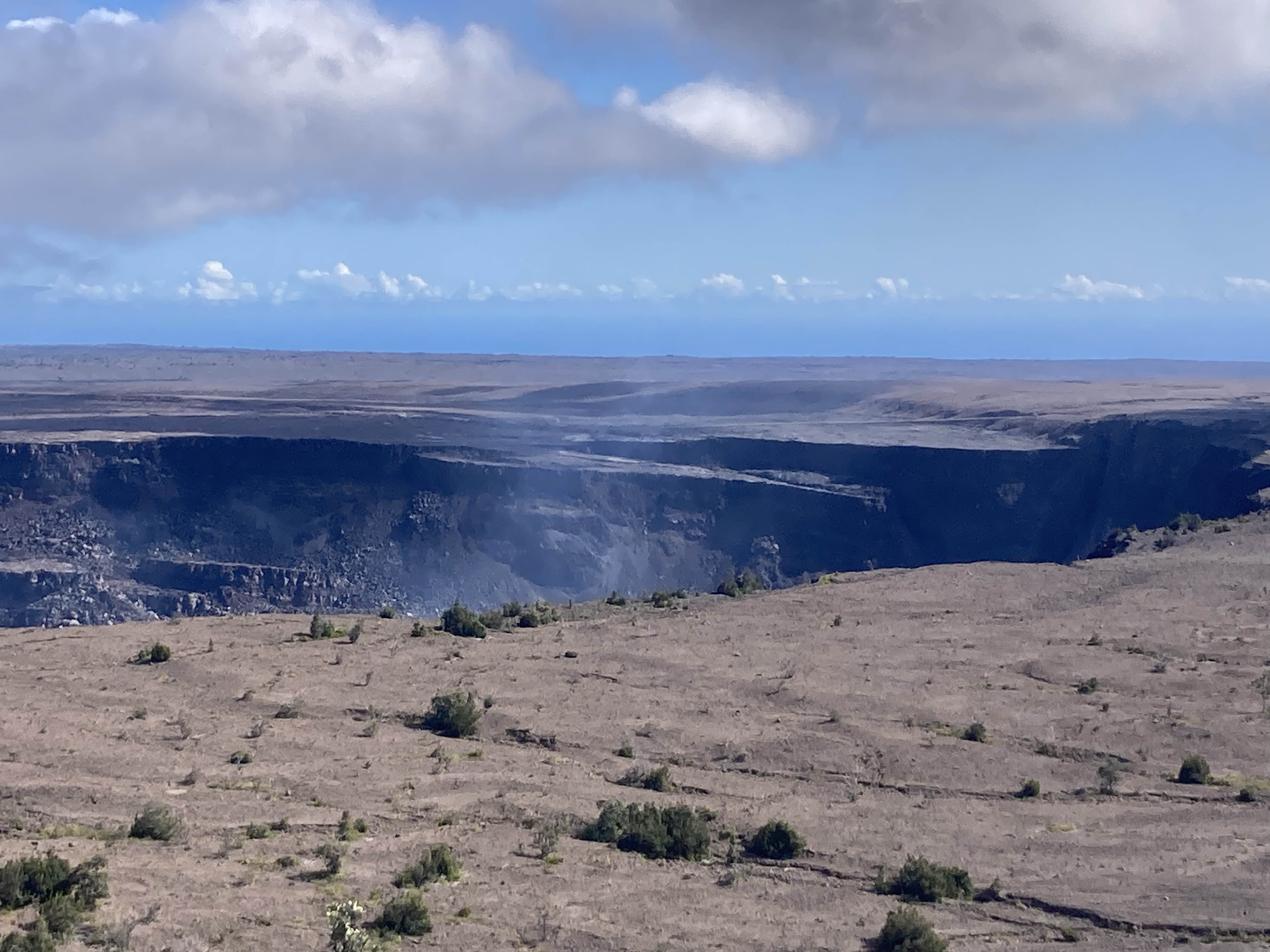
I have just returned from a couple of weeks in paradise — well at least Hawaii. So my mind is full of the delights I experienced including the sights and sounds of the place, the unusual plants, the wonderful people, the food and the geology. The geology is especially intriguing as one ponders how such a small bit of new land could form amidst such a vast ocean and then how Polynesian seafarers could find it in such an endless expanse.
Hawaii represents the most northern and most far-flung expanse of Polynesia. Their nearest Polynesian neighbor is about 1,200 miles away while the coast of California is about 2,500 miles distant. The islands were first colonized about 1,400 years ago. The ill-fated Captain Cook became the first western explorer to visit the island in 1778 and the transformation of the place and its population since then has been nothing short of astounding. Hawaii became the 50th state in 1959.
Even geologically speaking, these are new lands. The Hawaiian Islands owe their existence to a stationary underwater hotspot that belches up melted rock from deep within the earth’s mantle. It is typically considered to have eight main islands, but in fact is a long, straight line of 129 eroded volcanic mountains known collectively as a seamount which extends northwest for over 1,200 miles and includes the distant speck of land called Midway Island.
Mauna Loa, the tallest volcano on the big island of Hawaii at over 14,000 feet, is actually the tallest mountain in the world because almost 20,000 feet are below water. The island of Hawaii is home to two volcanos: the northern Mauna Kea, which is considered dormant and the southern Mauna Loa, which is still producing lava flows that occasionally spill into the sea.
The oldest rocks on this island are about 1.3 million years old, with the oldest rocks in the official Hawaiian-Emperor seamount chain found on Kure Aloi (northwest of Midway) and dated at 25 million years. As I write this a new undersea volcano called Kama’ehuakanaloa (previously known as Lo’ihi) is located 22 miles off the southwestern tip of Hawaii and is within 3,000 feet of the ocean surface. It is expected to break above the waves in 10,000 years or so. At a quarter inch of growth per year, it will take a while.
Hot spots exist in various places around the globe. The one we know best, the one under Yellowstone National Park, has had the North American plate pushed over it for millions of years and has produced massive lava flows that crept all the way to the Pacific coast. I was curious if the scattered islands found throughout the Southern Pacific were due to hotspots such as Hawaii and Yellowstone. Turns out that fewer than 14 are caused this way, leaving behind a train of older, more eroded islands in a straight line. In addition to Hawaii, the Society Islands, Samoan chain, Easter Island and the Galapagos chain are examples.
But other geologic factors contribute to island building. The subduction of one tectonic plate under another is a prime cause of volcanism forming in an “island arc.” Arkansas’ own Crater of Diamonds State Park is thought to be due to the collision of ancient plates coming together 300 million years ago to form the supercontinent of Pangea. An arc of volcanos formed, leaving behind only a few scattered gemstones as evidence of its existence. Japan is the best-known example of an archipelago forming from a series of 200 volcanos, 60 of which are still active, by tectonic plate subduction. The Solomon Islands and Fiji are also examples of plate tectonic-related events.
New Caledonia and New Zealand are examples of islands that broke off from the old continental margins of a landmass known as Zealandia and drifted off to do their own thing. The Baja Peninsula and California itself may sometimes follow the same course given a few hundred million years.
The Pacific Plate is the largest piece of uninterrupted crust on Earth so, not surprisingly it is subjected to all sorts of pressures as adjacent plates push and pull on it. Thinning of the crust as blocks separate can cause volcanos to form; bulges in the plate can force the seafloor to move upward, pushing coral hundreds of feet into the open air and creating limestone cliffs on islands such as Niue and Makatea. Or, atop old volcanos that have worn down to sea level, coral atolls can form when the coral surrounds the volcano but erosion eventually washes away the rock, leaving only the living coral as a wreath.
One can only marvel at the many ways new land is formed and at the ingenuity and perseverance it took for people traveling in simple wooden dugout canoes to discover it.